
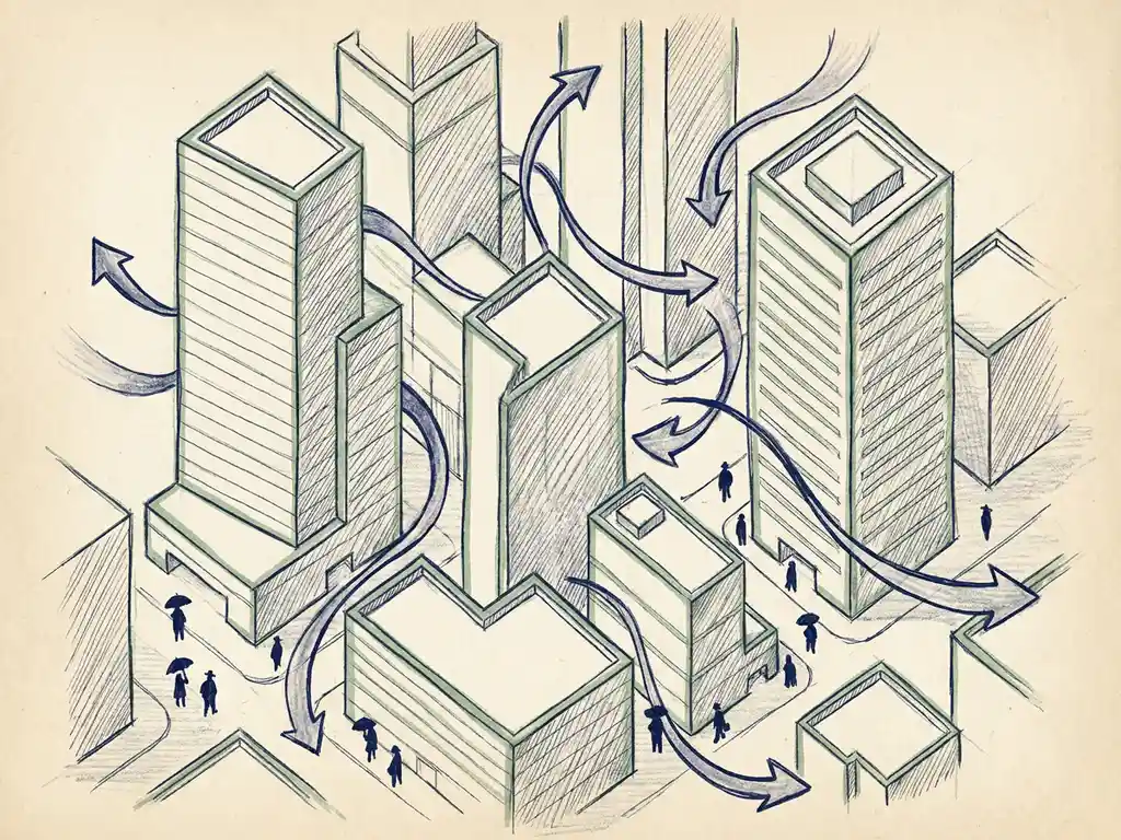
You can assess the wind microclimate around new developments using either CFD (Computational Fluid Dynamics) simulations or physical wind tunnel testing — or a combination of both. The method you choose depends on the scale of the project, the applicable standard, and the stage of the design process. This article walks through the main methods, the standards that apply, when an assessment is legally required, what a report looks like, and how the results actually influence design decisions.
Which methods are used to assess pedestrian wind conditions?
Two methods are widely accepted for assessing pedestrian wind conditions around buildings: wind tunnel testing and CFD simulation. Wind tunnel testing uses a physical scale model placed in a controlled airflow environment, while CFD uses computer simulations to model airflow patterns around a virtual 3D model of the development and its surroundings. Both methods produce reliable results when applied correctly.
The choice between them comes down to the scale and nature of the project. Wind tunnel testing works well for individual buildings and smaller masterplans, where a physical model can be built and tested accurately. For large-scale urban areas — think city-wide studies or complex area developments — CFD is the more practical and often more powerful option. A physical wind tunnel simply cannot replicate the full complexity of an entire urban district.
In a CFD workflow, the process typically runs in three stages. First, a detailed 3D model is built from geodata, incorporating existing and approved buildings in the surrounding area. Second, the airspace above and between buildings is divided into a computational mesh of cells — in large-scale studies, this can run into hundreds of millions of cells. Third, the raw simulation results are processed into visual outputs: colour-coded maps showing wind speeds at pedestrian height across the entire study area.
For wind engineering projects that span a whole neighbourhood or city district, CFD is the standard approach. It allows multiple wind directions and scenarios to be simulated in a single study run, and the results can be adapted into different thematic maps depending on what planners, architects, or permit authorities need to see.
What standards and criteria apply to wind microclimate studies?
The two most widely used standards for wind microclimate assessments are NEN 8100 (used in the Netherlands) and the Lawson criteria (used internationally, particularly in the UK and other countries). Both standards classify wind conditions at pedestrian level based on how often wind speeds exceed a defined threshold, but they use different reference values and activity categories.
NEN 8100 (Netherlands)
NEN 8100 measures the probability that wind speed at eye height (1.75 m) exceeds 5 m/s. Based on this exceedance probability, locations are classified from Class A (excellent) to Class E (poor) for three types of activity: sitting, strolling, and walking through. Wind danger is assessed separately, based on the probability that wind speed exceeds 15 m/s. An exceedance probability above 0.30% is considered unacceptable. NEN 8100 is the legally prescribed standard for permit procedures in the Netherlands, with meteorological input derived from the NPR 6097 wind dataset covering 1963 to 2002.
Lawson criteria (international)
The Lawson criteria use a similar logic but apply different thresholds and activity categories. They are the standard reference for projects in the UK and many other countries outside the Netherlands. If you are working on a development in London, Gibraltar, or the Middle East, Lawson is the framework your assessment will be judged against. The underlying wind data and exceedance thresholds differ from NEN 8100, so the two standards are not directly interchangeable.
Knowing which standard applies to your project is not always straightforward, especially for international developments or projects near borders. Getting this wrong early can mean redoing the assessment later — which is exactly the kind of delay you want to avoid.
When is a wind microclimate assessment legally required?
In the Netherlands, a wind microclimate assessment is legally required when a new development is likely to significantly affect pedestrian wind conditions. This is most commonly triggered by tall buildings, high-rise clusters, or large area developments that change the existing wind environment. Many municipalities include wind assessment requirements directly in their environmental plans or permit conditions.
The general rule of thumb: if a building is more than twice the height of its immediate surroundings, it is very likely to create wind issues at street level and a study will be required. Beyond height, factors like building orientation, proximity to open water or wide streets, and the presence of passages or canopies through a building all increase the likelihood that a wind assessment will be requested.
Outside the Netherlands, requirements vary by country and municipality. In the UK, wind assessments are commonly required as part of the planning application process for tall buildings, particularly in London boroughs. Local planning authorities set their own thresholds, but the Lawson criteria provide the standard framework for evaluation.
Even when a wind study is not strictly required by law, many developers and architects commission one voluntarily — particularly to validate a design before committing to it, or to identify wind issues early enough to address them without costly redesigns. The Actiflow overview page gives a good sense of the range of projects where this applies.
What does a wind microclimate report include?
A wind microclimate report typically includes a description of the methodology used, the input data and wind climate applied, the results of the assessment, and a classification of wind conditions at pedestrian level across the study area. The core output is a set of colour-coded maps showing wind comfort and wind danger classifications for each location in and around the development.
For NEN 8100 assessments, the report will show the exceedance probability of 5 m/s at eye height for each assessed location, mapped against the classification table (Class A through E). Wind danger results — based on the 15 m/s threshold — are reported separately. The report will also state whether the wind conditions are acceptable for the intended use of each outdoor space: a terrace, an entrance, a public square, or a through-route all have different acceptability criteria.
Beyond the classification maps, a good report includes design recommendations. If certain locations score poorly, the report should explain what is causing the problem and suggest practical measures — whether that is a setback in the building volume, an arcade, a canopy, or a change in orientation. Colour-coded visuals are important here: they make the results directly presentable to clients, planners, and permit authorities without requiring a deep technical background to interpret.
How do wind assessment results influence building design decisions?
Wind assessment results directly influence decisions about building volume, orientation, facade treatment, and the placement of outdoor functions. When results show that a location scores poorly for wind comfort or crosses into wind danger territory, the design team has several options — and the earlier in the process these results are available, the easier and cheaper the fixes tend to be.
The most effective interventions happen at the urban planning level. Some practical design rules that follow directly from wind assessment findings:
- Building height differences: Keep height differences between adjacent buildings within roughly 30% to avoid accelerated downwash between towers.
- Tower clustering: Group tall buildings so they shelter each other — the so-called Manhattan effect — rather than placing isolated towers in open areas.
- Street orientation: Orient streets perpendicular or diagonally to the prevailing wind direction, not parallel, to avoid channelling effects.
- Setbacks: A stepped building profile with setbacks of at least 5 metres (for a building around 100 metres tall) can redirect downward airflow away from street level.
- Facade geometry: Rounded or tapered facades allow wind to flow around the building rather than straight down to the pavement.
- Function placement: Keep terraces, playgrounds, and building entrances away from the windiest locations — sometimes moving a bench or entrance by just a few metres is enough.
When wind problems are only discovered after the building volume is fixed, the options narrow considerably. Canopies, screens, and planting can help at the margins, but they are less effective than upstream design changes. This is why integrating wind assessment into the early design phase — rather than treating it as a permit formality at the end — saves time, money, and redesign headaches.
How Actiflow helps with wind microclimate assessments
We have been carrying out pedestrian wind assessments since 2005, with over 21 years of experience across the Netherlands, Belgium, the UK, Gibraltar, and beyond. Our team knows the regulatory landscape inside out — whether your project falls under NEN 8100 or the Lawson criteria, we advise you on which study is needed and make sure the report holds up under scrutiny from permit authorities.
Here is what working with us looks like in practice:
- We assess wind conditions using advanced CFD simulations — our virtual wind tunnel — as well as physical wind tunnel testing and field measurements, depending on what your project needs.
- We deliver colour-coded maps and clear visual outputs that you can share directly with clients, planners, and municipalities — no translation required.
- We cover the full scale range: from a single high-rise to city-wide area studies, including the comprehensive wind study we carried out for the city of Rotterdam.
- We are known for speed and flexibility. For regular clients, we set everything aside and start the next day if needed. Internal process automation continues to reduce delivery times further.
- We stay close to the project from intake to final report — one point of contact, no handoffs.
- For projects outside the Netherlands, we apply the Lawson criteria and are familiar with local planning requirements in the UK and other markets.
Curious how we can help with your wind microclimate assessment? Contact us — we would be happy to discuss your project and help you find the right approach. You can also find out more about us and the team behind the work.
