
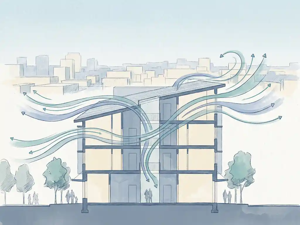
Interpreting wind engineering assessment results means understanding two things: where wind conditions fall short of comfort or safety standards, and what those findings mean for your design. The colour-coded maps show you which areas around a building are problematic, while the classification system (NEN 8100 in the Netherlands, or the Lawson criteria for international projects) tells you exactly how serious those problems are. Below, we answer the most common questions project managers and structural engineers ask when a wind report lands on their desk.
What do the colour-coded zones in a wind assessment map mean?
Each colour in a wind assessment map represents a wind comfort class for a specific outdoor location. The colours show how often wind speeds at pedestrian height (1.75 m) exceed a set threshold, typically 5 m/s. Green zones are comfortable for most activities; red or dark zones signal conditions that are too windy for the intended use of that space.
The maps are generated from CFD simulations that calculate wind conditions across hundreds of points around a building or area. Once the simulation is complete, each point is assigned a class based on how frequently strong winds occur there. The result is a spatial overview you can read at a glance, which is exactly why these maps are so useful for presenting findings to clients, planners, or permit authorities.
In practice, the colour scale follows the classification system used in the assessment, whether NEN 8100 or the Lawson criteria. A zone coloured class A (or equivalent) means conditions are comfortable for sitting, strolling, or passing through. A zone flagged in the most critical class means conditions are genuinely dangerous and require intervention. The map also distinguishes between different activity types: a terrace needs a stricter standard than a through-route, so the same wind speed can be acceptable in one context and unacceptable in another.
Our wind engineering team produces these maps using advanced CFD simulation technology, with colour coding that is directly presentable to municipalities and permit authorities without further translation.
What are the Lawson criteria and how are they used to classify wind comfort?
The Lawson criteria are a wind comfort classification system widely used in the UK and internationally. They classify outdoor spaces into five categories based on how often wind speeds exceed defined thresholds at pedestrian height. Each category corresponds to a type of activity, from sitting in a sheltered café terrace to walking briskly through a public square.
The five Lawson categories run from comfortable sitting conditions through to frequent pedestrian use, occasional use, and finally unsafe conditions where wind poses a physical risk. For each category, there is a defined wind speed threshold and an acceptable exceedance frequency. A location classified as suitable for sitting, for example, must not exceed that threshold more than a certain percentage of the time.
The Lawson criteria are used by planning authorities in London, other major UK cities, and many international jurisdictions. When a project is subject to a planning application in those locations, the wind assessment must demonstrate that the proposed development meets the Lawson standard for each area around the building based on its intended use. For international projects, we apply the Lawson criteria and have direct experience working with planning requirements in the UK, Gibraltar, and beyond.
How does NEN 8100 differ from the Lawson criteria?
NEN 8100 is the Dutch standard for pedestrian wind comfort, and it differs from the Lawson criteria primarily in its classification structure, thresholds, and regulatory context. NEN 8100 uses five classes (A through E) based on the exceedance frequency of 5 m/s at eye height, while the Lawson criteria use a different set of thresholds and activity-based categories. Both assess pedestrian comfort, but they are not directly interchangeable.
Under NEN 8100, a class A result means wind speeds above 5 m/s occur less than 2.5% of the time (fewer than 219 hours per year). Class E means that threshold is exceeded more than 20% of the time, which is considered poor for any outdoor activity. NEN 8100 also separately addresses wind danger, using a threshold of 15 m/s and defining two risk levels: limited risk and dangerous.
The Lawson criteria use different speed thresholds and link each category directly to a specific activity type, making the assessment slightly more context-sensitive in its structure. In the Netherlands, NEN 8100 is the legally prescribed standard for permit procedures and uses meteorological input data from the NPR 6097 dataset covering 1963 to 2002. For Dutch projects, this is what municipalities expect to see in a permit application. For UK and international projects, the Lawson criteria are the applicable framework. Knowing which standard applies to your project is not always straightforward, and getting it wrong can mean a report that does not hold up with the relevant authority.
What wind comfort result is considered acceptable for a building permit?
Acceptability depends on both the classification system used and the intended use of the outdoor space in question. Under NEN 8100, a class A or B result is generally considered good for any outdoor activity. Class C may be acceptable for walking routes but not for sitting areas. Classes D and E are considered poor and will typically require mitigation before a permit is granted.
For wind danger under NEN 8100, the standard is stricter. An exceedance frequency above 0.30% for wind speeds over 15 m/s is classified as dangerous and is considered unacceptable regardless of location. Between 0.05% and 0.30%, the result falls into a limited risk category that may be acceptable depending on the specific location and its function.
Under the Lawson criteria, the acceptable category depends on what the space is designed for. A public square intended for sitting needs a better result than a pedestrian through-route. Planning authorities in London and other UK cities have published guidance on which Lawson category is acceptable for each type of outdoor space, and assessments must demonstrate compliance with those thresholds for the application to proceed. The Actiflow overview page gives a clear picture of the full range of wind studies we carry out across both frameworks.
What design changes can fix a poor wind comfort result?
Poor wind comfort results can be addressed through changes at three levels: urban layout, building volume and orientation, and local mitigation measures. The most effective interventions happen early in the design process, before the building geometry is fixed.
Urban layout and massing
At the urban scale, the most effective approach is clustering towers so they shelter each other, a principle sometimes called the Manhattan effect. Height differences between adjacent buildings should stay within roughly 30% to avoid strong downwash effects. Street orientation also matters: streets running parallel to the prevailing wind direction create a channel effect that accelerates wind, so orienting streets at an angle to the dominant wind direction reduces this risk.
Building volume and facade design
At the building level, setbacks are one of the most reliable tools. A stepped facade reduces the downward flow of wind that would otherwise hit pedestrians at street level. As a rule of thumb, a setback needs to be at least 5 metres deep for a building around 100 metres tall to be effective. Avoiding wide facades perpendicular to the prevailing wind direction also reduces the pressure differential that drives wind around corners. Openings and passages aligned with the dominant wind direction create pressure shortcuts that accelerate wind, so these should be minimised or redesigned if possible.
Local mitigation measures
When the building design is largely fixed, local measures such as windscreens, canopies, dense planting, and low walls can reduce wind speeds in specific problem areas. These are less effective than upstream interventions but can bring a borderline result into an acceptable class. The key is targeting the right locations, which is exactly what the wind assessment map makes possible.
When should wind assessment results trigger a redesign versus a mitigation measure?
A redesign is appropriate when wind problems are structural, meaning they arise from the fundamental massing, height, or orientation of the building. A mitigation measure is appropriate when the issue is localised and can be resolved without changing the building’s core geometry. The earlier in the design process the assessment takes place, the more options you have.
If results show wind danger (class D or E under NEN 8100, or an unsafe Lawson classification) across large areas of a public space, local measures are unlikely to be sufficient. The problem typically originates from the building’s interaction with the wind at a scale that a windscreen or planting cannot resolve. In these cases, revisiting the massing, adjusting tower height, or introducing setbacks is the more defensible path, both technically and in terms of what a permit authority will accept.
For localised problems, such as a single corner that performs poorly while the rest of the site is acceptable, targeted mitigation is often the right response. A canopy, a change in facade detailing, or a planted buffer can bring that specific location into compliance without touching the rest of the design. The wind assessment map makes it straightforward to identify which category a problem falls into, because you can see immediately whether the issue is concentrated in one spot or spread across the whole site.
One important principle: wind issues discovered late in the design process are significantly more expensive to fix. A quick scan early on, even before detailed design is complete, can flag risks while there is still room to adjust the scheme without major cost implications. Our CFD simulation process works with simple volume models, so you do not need a finished design to get useful early-stage feedback.
How Actiflow helps you interpret and act on wind assessment results
We have been carrying out wind assessments since 2005, working with real estate developers, architects, structural engineers, and municipalities across the Netherlands, Belgium, the UK, and beyond. We know what permit authorities expect to see, and we produce reports that hold up under scrutiny, whether the applicable standard is NEN 8100 or the Lawson criteria.
- Colour-coded maps and visual output that you can share directly with clients, planners, and permit authorities without further explanation
- Clear classification of every outdoor zone against the relevant standard, with a plain-language explanation of what the results mean for your project
- Design advice based on the results, including specific recommendations for setbacks, massing changes, or local mitigation measures
- Familiarity with local regulations, including the specific requirements of Dutch municipalities and UK planning authorities
- Experience across all project scales, from individual high-rise assessments to city-wide studies such as the comprehensive wind study we carried out for the city of Rotterdam
- Fast turnaround, with a high degree of process automation and the flexibility to prioritise urgent projects
Curious how we can help with interpreting your wind assessment results? Contact us and we will be happy to discuss your project and help you find the right engineering solution. You can also find out more on our about us page.
