
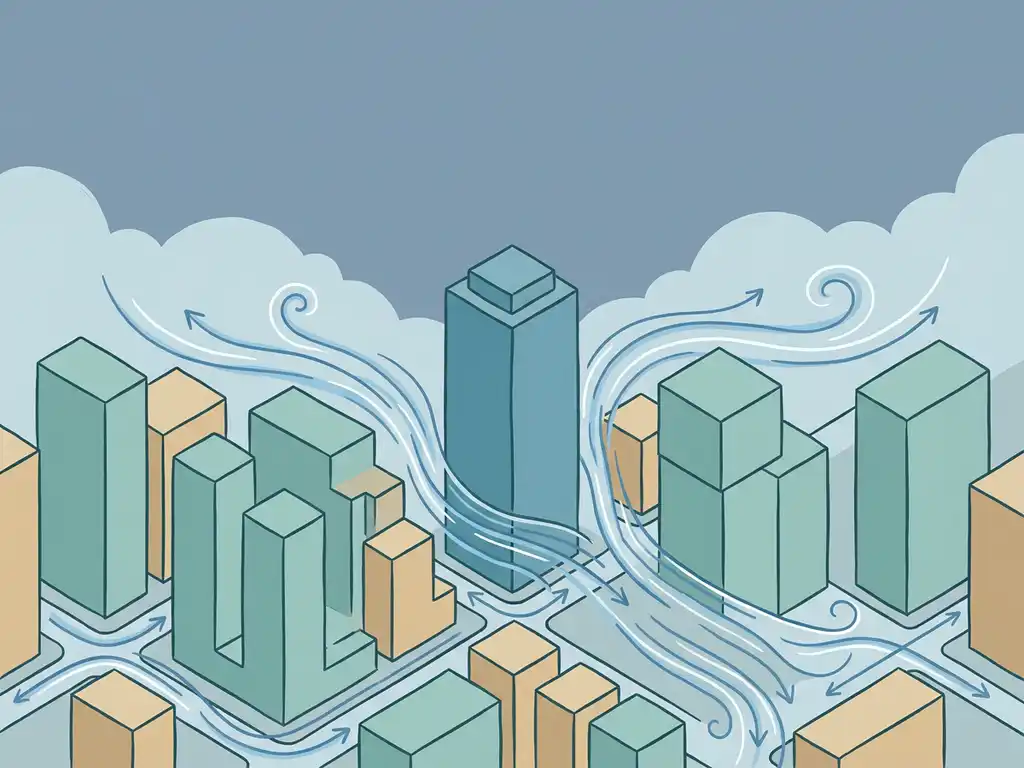
Six factors consistently increase wind risk in city centers: building height relative to surroundings, building shape and orientation, street canyon geometry, gaps and passages between buildings, surrounding urban density, and open plaza configurations. Each one changes how wind moves through the urban fabric, and when several factors combine in one location, the risk to pedestrian safety and comfort rises sharply. The sections below explain exactly how each factor works and what it means for your project.
Which building shapes create the most dangerous wind conditions?
Flat, wide facades oriented perpendicular to the prevailing wind direction create the most dangerous conditions at street level. A broad, flat surface acts like a wall that stops moving air and forces it downward, creating powerful downdrafts that accelerate as they approach the ground. Rounded, tapered, or angled facades let air flow around the building rather than straight down toward pedestrians.
The risk is not just about the facade itself. Passages and openings through a building that face the dominant wind direction create what engineers call pressure short-circuiting: air rushes through the gap at high speed because there is a direct path from the high-pressure windward side to the low-pressure leeward side. If such a passage is unavoidable in your design, making it as narrow as possible limits the acceleration effect.
Setbacks, where the building steps back at a certain height, can help redirect downward airflow before it reaches street level. As a rule of thumb, a setback needs to be at least 5 meters deep for a building around 100 meters tall to be effective. The roof level of the setback itself, however, sits directly in the downward airstream and is not suitable as an occupied terrace or outdoor space.
How does building height increase wind speed at street level?
Wind speed increases with height above the ground. When a tall building intercepts fast-moving air high up and redirects it downward, that higher-speed air reaches street level and creates conditions far windier than the surrounding area would normally experience. The taller the building relative to its neighbors, the stronger this effect.
A useful rule of thumb: a building that stands more than twice the height of its immediate surroundings significantly increases the probability of wind problems at ground level. The downdraft it generates can push wind speeds well above what pedestrians experience in the open street further away from the tower.
This is why height differences between adjacent buildings matter so much. Keeping the height difference between neighboring buildings within roughly 30% reduces the risk of one building channeling strong winds down onto a lower neighbor’s entrance or public space. Clustering towers of similar height, the so-called Manhattan approach, means they shelter each other rather than each one independently generating downwash onto the street below. Our wind engineering work consistently shows that poorly matched building heights are one of the most common and avoidable causes of pedestrian wind problems.
What is the canyon effect and why is it dangerous in city centers?
The canyon effect occurs when streets flanked by tall buildings on both sides channel wind along the street corridor, accelerating it significantly compared to open terrain. The narrower the street relative to building height, the more pronounced the channeling. In city centers, where streets are often both narrow and lined with tall facades, this effect can push wind speeds to uncomfortable or even unsafe levels.
The ratio of building height to street width (H/W) is the key variable here. When H/W drops below 0.35, most wind reaches the street with little obstruction. Between 0.35 and 0.65, there is partial sheltering, and you need to weigh wind comfort against ventilation needs. Above 0.65, most wind passes over the rooftops rather than through the street, which generally improves pedestrian comfort but reduces natural ventilation of the street.
The danger in city centers is that streets are often oriented parallel to the dominant wind direction, which turns them into natural wind tunnels. Orienting streets perpendicular or diagonally to the prevailing wind breaks up the channeling effect and distributes airflow more evenly across the urban grid. Where street orientation is fixed by existing urban structure, building design and ground-floor interventions become the primary tools for managing the canyon effect.
How do gaps between buildings affect pedestrian wind risk?
Gaps between buildings create pressure differences that accelerate wind through the opening, often producing the highest local wind speeds in an entire development. Air flows from the high-pressure windward side to the low-pressure leeward side through the path of least resistance, and a gap between two buildings is exactly that path. The narrower the gap relative to building height, the faster the air moves through it.
Ground-floor passages, open podium levels, and colonnades all share this characteristic. They can be architecturally attractive and useful for pedestrian circulation, but without careful design, they become wind hazards. The Rotterdam pilot study we conducted for the city confirmed that even buildings of moderate height, around 70 meters in the Lloydpier area, generate strong downward flows that reach pedestrian level and create measurable wind nuisance, particularly where the building geometry creates unintended gaps or recesses.
If your design includes a passage or opening, aligning it away from the dominant wind direction reduces the pressure differential and limits acceleration. Where that is not possible, minimizing the opening size and adding canopies or screens at the edges can help manage the worst of the effect, though these measures address symptoms rather than the underlying cause.
Why does surrounding urban density change wind risk levels?
Dense urban surroundings slow wind down before it reaches a building, while open surroundings allow it to arrive at full speed. A tower standing in a low-rise neighborhood or next to a river, park, or open waterfront is exposed to much stronger approaching winds than the same tower placed within a dense urban core. The surrounding fabric acts as a natural windbreak, and its absence is a significant risk factor.
This is one reason why locations near water are consistently among the windiest spots in urban wind studies. In the Rotterdam pilot study, the dominant southwest wind blows unobstructed across the Waalhaven’s low industrial buildings and the river itself before hitting the city’s taller structures. The result is that areas near the riverfront, including the Erasmusbrug and parts of the Lloydpier, show wind conditions far more severe than their position within the city would suggest.
For project managers and structural engineers, this means that the wind exposure of the site, not just the building itself, needs to be assessed early. A site that appears sheltered on a map may be fully exposed in practice if the surrounding buildings are low, sparse, or oriented in a way that funnels rather than blocks the prevailing wind. You can explore how fluid dynamics consultancy approaches this kind of site-level analysis before design decisions are locked in.
When should a wind study be carried out to catch these risks early?
A wind study delivers the most value when it is commissioned at the concept or schematic design stage, before building volumes, orientations, and street layouts are fixed. At that point, findings can directly inform design decisions: adjusting a facade angle, repositioning a tower, or redesigning a ground-floor passage costs relatively little. Discovering a wind problem after detailed design or during permit review is far more expensive to resolve.
In the Netherlands, a wind study is often required as part of the permit application when a building exceeds a certain height or when the municipality identifies wind comfort as a point of concern. Waiting until that moment to commission the study means working under time pressure and with limited room to act on the results. Commissioning it earlier gives you both better outcomes and a smoother permit process.
For large area developments or masterplans, a city-scale wind assessment at the urban planning stage can identify which plots and street configurations carry the highest risk before any individual building design begins. This is exactly the type of study we carried out for the city of Rotterdam, covering a 5-kilometer diameter study area with more than 583 million computational cells, producing thematic maps that planners and designers could use directly in their work.
How Actiflow helps you identify and manage wind risk
We work with project managers, structural engineers, architects, and municipalities to assess wind risk at every scale, from a single high-rise to a city-wide masterplan. With over 21 years of experience in CFD simulations and wind engineering, we know which factors matter most at each stage of a project and how to translate simulation results into clear, actionable recommendations.
- Early-stage risk screening to identify problem locations before design decisions are locked in
- Pedestrian wind comfort assessments using NEN 8100 (Netherlands) or Lawson criteria (international projects), with colour-coded maps that you can submit directly to permit authorities
- Wind loading studies for facades and load-bearing structures, delivered in formats that structural engineers and cladding contractors can work with immediately
- Large-scale area assessments for masterplans and urban developments, covering multiple buildings and street configurations in a single study
- Fast turnaround: for regular clients, we set everything aside to start the next day if needed, and our internal automation continues to reduce delivery times further
- Clear visual output: every report includes graphics and maps designed to be presentable to clients, planners, and permit authorities without additional translation
Curious how we can help with wind risk in your project? Contact us and we will be happy to discuss your project and help you find the right approach. You can also find out more about our team and background on our about us page.
