
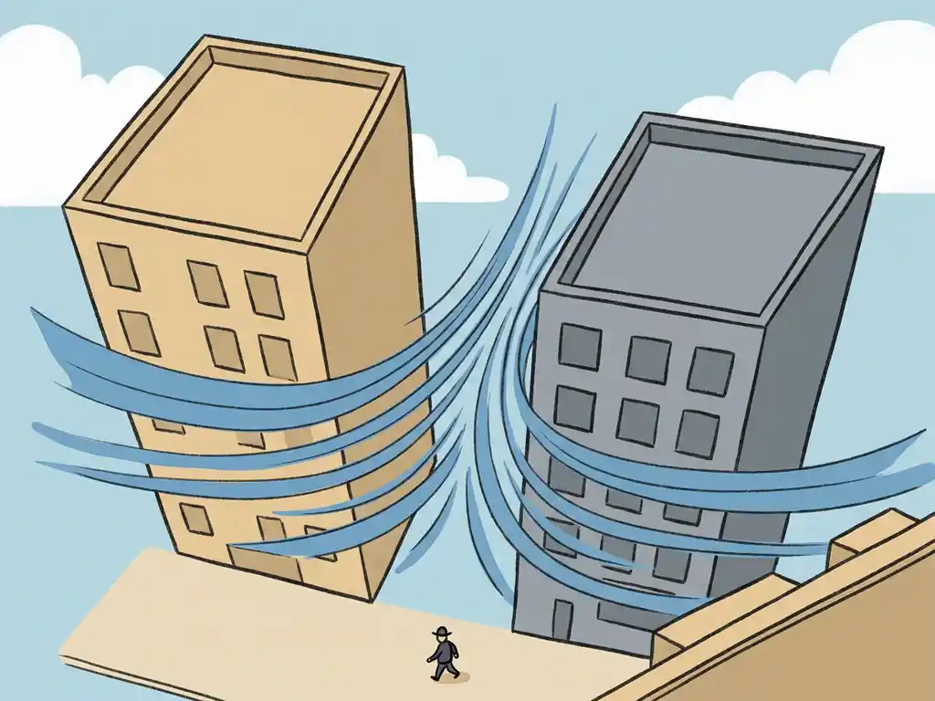
Wind speed increases between buildings because of how air behaves when it is forced through a narrower space. When the open flow of wind hits a building, it cannot pass through the structure, so it is redirected around the sides, over the top, and down toward street level. The result is a concentration of airflow in the gaps between buildings, which can raise local wind speeds well above what you would measure in the open. This article unpacks the specific mechanisms behind that acceleration, the building shapes and layouts that make it worse, and what you can do about it.
Why does wind speed up when it passes between buildings?
Wind speeds up between buildings because a large volume of moving air is suddenly forced through a smaller opening. This is the same principle that makes a garden hose spray further when you put your thumb over the end. When wind hits a building facade, the air mass has to go somewhere. It splits and flows around the sides and over the roof, compressing into the gaps between structures. That compression raises the local wind speed significantly compared to the undisturbed flow further away.
The technical name for this is the Venturi effect, and it is one of the most predictable phenomena in urban wind engineering. The narrower the gap relative to the volume of air approaching it, the stronger the acceleration. Even a moderate background wind speed of 5 m/s can produce genuinely uncomfortable or hazardous conditions at street level when this effect is at play.
This is not just a nuisance. Under wind engineering standards such as NEN 8100 in the Netherlands, wind speeds at pedestrian level are classified from comfortable (Class A) through to dangerous (Class E). A location that consistently exceeds 5 m/s has a measurable comfort problem. One that regularly hits 15 m/s is classified as a safety hazard.
What building shapes and layouts create the strongest wind acceleration?
The strongest wind acceleration occurs when tall, wide buildings present a large flat facade perpendicular to the prevailing wind direction, combined with narrow gaps between adjacent structures. Buildings that are more than twice the height of their surroundings are particularly likely to generate wind problems, because they intercept a much larger column of moving air and redirect it downward and sideways.
A few specific configurations consistently produce the worst results:
- Wide facades facing the wind: A broad, flat building face acts like a wall that deflects enormous volumes of air into the gaps on either side.
- Passages and openings aligned with the dominant wind direction: Ground-floor passages or gaps between buildings that point directly into the prevailing wind create a pressure shortcut. Air rushes through at high speed because the pressure difference between the windward and leeward sides drives it forward.
- Large height differences between adjacent buildings: When one building is significantly taller than its neighbour, the taller structure generates strong downward flows that hit street level at its base. A rule of thumb: keep height differences between adjacent buildings below 30% to reduce this risk.
- Isolated towers with no surrounding buildings for shelter: A freestanding high-rise has no neighbouring structures to absorb or redirect the flow. The Lloydpier area in Rotterdam is a practical example: despite a maximum height of around 70 metres, the area experiences surprisingly high wind nuisance because south-westerly winds blow unobstructed across the low industrial buildings of the Waalhaven before hitting the towers directly.
What is the corner effect and how does it differ from the channeling effect?
The corner effect and the channeling effect are two distinct mechanisms that both raise wind speed at street level, but they work differently and occur in different locations.
The corner effect happens at the edges of an individual building. When wind hits a facade, it wraps around the corners and accelerates as it does so. The flow separates from the building surface at the corner and creates a zone of high velocity immediately beside and behind the building edge. This is a very localised phenomenon, concentrated within a few metres of the corner itself. Rounded or tapered building corners reduce this effect by allowing the air to follow the surface more smoothly instead of separating sharply.
The channeling effect (also called street canyon channeling) is a larger-scale phenomenon that occurs between two buildings or along a street corridor. When a street is oriented parallel to the prevailing wind direction, the buildings on either side act like walls of a channel. The wind accelerates along the full length of the corridor rather than just at a single point. The wider the street relative to building height, the more wind reaches the ground. The ratio of building height to street width (H/W) matters here: an H/W above 0.65 tends to push most of the wind over the rooftops, while an H/W below 0.35 allows most of the wind to reach the street.
How do urban density and street orientation affect wind conditions?
Urban density and street orientation are two of the most powerful variables in determining how wind behaves at street level. Dense, low-rise urban fabric with consistent building heights tends to create a relatively smooth surface that guides wind over the rooftops. Sparse high-rise development with large open spaces between towers tends to produce stronger and more variable wind conditions at ground level.
Street orientation is equally important. Streets that run parallel to the prevailing wind direction act as channels that funnel and accelerate the flow. Orienting streets perpendicular or at a diagonal to the dominant wind direction interrupts this channeling and reduces average wind speeds along the street. In the Netherlands and much of north-west Europe, the dominant wind direction is south-westerly, which means north-east to south-west oriented streets are the most prone to channeling effects.
Open squares and plazas present their own challenge. When more than 25% of the windward facade of a square is open, the probability of wind nuisance increases significantly. This is a practical threshold that urban designers can use when laying out public spaces.
The “Manhattan effect” is a useful concept here. Clustering towers together so they shelter one another reduces the overall wind impact compared to scattering the same towers across a wider area. The Wijnhaveneiland development in Rotterdam demonstrates this well: strategic clustering and the use of setbacks resulted in nearly the entire area achieving a Class A wind comfort classification.
When do high wind speeds between buildings become a safety or comfort problem?
High wind speeds between buildings become a comfort problem when pedestrian-level wind speeds regularly exceed 5 m/s, and a safety hazard when they regularly exceed 15 m/s. These are the threshold values used in the NEN 8100 standard. The Lawson criteria, used for international projects, apply a comparable framework based on the frequency with which specific wind speeds are exceeded.
In practice, the classification depends not just on wind speed but on how often it occurs and what activity takes place at that location. A wind speed that is acceptable in a through-route becomes unacceptable on a terrace or at a children’s playground entrance. The relevant questions are:
- What is the intended use of the space? (passing through, sitting, standing, playing)
- How often does the wind exceed the threshold for that activity?
- Is the location near a building entrance, public transport stop, or outdoor seating area?
Bridges and riverbanks are consistently among the most exposed locations in urban environments, because they lack the sheltering effect of surrounding buildings. In Rotterdam, the Erasmusbrug and sections of the Willemsbrug are classified as wind hazard locations under NEN 8100, meaning wind speeds there regularly exceed 15 m/s at a frequency that makes them genuinely dangerous. These findings come from large-scale urban wind studies that assess entire city districts rather than individual buildings.
How can a wind study identify and resolve channeling problems early in design?
A wind study can identify channeling problems early in design by simulating airflow through a three-dimensional model of the proposed development before anything is built. CFD (Computational Fluid Dynamics) simulations produce colour-coded maps showing wind speed and comfort classification at pedestrian level across the entire site. These maps make it immediately visible where channeling, corner acceleration, or downwash effects are likely to occur.
The earlier in the design process a wind study is commissioned, the more options you have. At concept stage, you can still change street orientation, adjust building heights, or reposition towers. Later in the process, your options narrow to mitigation measures such as setbacks, canopies, screens, or planting, which are less effective and more expensive than getting the layout right from the start.
Practical design adjustments that a wind study can validate include:
- Adding setbacks to tall buildings (a minimum depth of 5 metres is recommended for buildings around 100 metres tall)
- Narrowing or re-angling passages that align with the dominant wind direction
- Adjusting the H/W ratio of streets to push more wind over the rooftops
- Relocating entrances, terraces, and public seating away from the windiest spots
- Clustering towers to create mutual sheltering
Identifying these issues late, after permit applications have been submitted or construction has begun, means costly design revisions and potential delays. A wind study at the right moment saves time, money, and the frustration of discovering a wind hazard that could have been designed out from the beginning.
How Actiflow helps with wind speed problems between buildings
We specialise in exactly this kind of problem. With over 21 years of experience in wind engineering, we carry out pedestrian wind comfort assessments and wind loading studies for projects of all scales, from individual high-rise buildings to city-wide masterplans like the comprehensive wind study we completed for the city of Rotterdam.
Here is what working with us looks like in practice:
- CFD simulations that produce colour-coded pedestrian wind maps, ready to submit to municipalities or share directly with clients and planners
- NEN 8100 and Lawson assessments, so whether your project is in the Netherlands, Belgium, the UK, or further afield, we apply the right standard
- Early design advice, not just a report at the end, so wind findings actually influence design decisions before they become expensive to change
- Fast turnaround, with a high degree of process automation and, for regular clients, the ability to start the next day if the schedule demands it
- Clear, visual output that works for technical reviewers, planners, and permit authorities alike
Curious how we can help with wind speed problems between buildings? Contact us. We would be happy to discuss your project and help you find the right engineering solution. You can also find out more about us and the work we do.
