
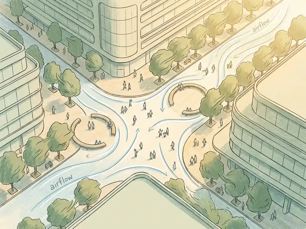
You can improve wind comfort in public spaces by addressing the problem at the right scale and in the right order: start with urban layout, then building geometry, then architectural details, and finally landscaping and furniture placement. The most effective improvements happen early in the design process, before construction begins. This article walks through the key questions designers, developers, and project managers ask when wind comfort becomes part of the brief.
What makes a public space wind-comfortable or uncomfortable?
A public space is wind-comfortable when the wind speeds people experience match what they are actually doing there. Sitting at a terrace requires calmer conditions than walking through a shopping street. Wind comfort is compromised when speeds regularly exceed what the activity demands, or when gusts create sudden, unpredictable conditions that feel unsafe.
The wind engineering framework used most widely in the Netherlands is NEN 8100, which classifies wind conditions into five categories (A through E) based on exceedance probability. Class A means conditions are suitable for all activities. Classes D and E indicate nuisance or danger, and Class E is considered unacceptable regardless of the function. For international projects, the Lawson criteria serve the same purpose.
Several factors push a space toward the uncomfortable end of the scale:
- Exposed location above open water or flat terrain, where wind arrives unobstructed at full speed
- Corner acceleration around building edges, which concentrates airflow into narrow zones
- Downwash from tall buildings, where wind from upper floors is deflected to street level
- Funnel effects between buildings, which increase wind speed through narrow gaps or passages
- Dominant wind direction aligned with streets or open plazas, creating channel flow
Understanding which of these mechanisms is at play in a specific location is the starting point for any meaningful improvement.
How does building geometry affect wind conditions at street level?
Building geometry is one of the strongest drivers of wind conditions at street level. A tall building placed in a lower-rise context accelerates wind downward along its facade and outward at ground level. A useful rule of thumb: a building more than twice the height of its surroundings is likely to cause wind problems nearby.
Several geometric factors determine how much wind reaches pedestrians:
- Height-to-width ratio of the street (H/W): When H/W exceeds 0.65, most wind is carried over the roofline rather than into the street. When H/W falls below 0.35, most wind reaches street level with little reduction.
- Facade orientation: A wide facade perpendicular to the prevailing wind direction catches and deflects far more wind than a narrow or angled one.
- Openings and passages: Gaps at ground level aligned with the dominant wind direction create pressure short-circuits, dramatically increasing local wind speed.
- Height differences between adjacent buildings: Differences greater than roughly 30% between neighbouring buildings increase the risk of downwash. Clustering towers of similar height, sometimes called the Manhattan effect, reduces this.
- Plaza openness: When more than 25% of the windward side of a plaza is open facade, the risk of wind nuisance increases significantly.
Streets oriented parallel to the prevailing wind direction are especially vulnerable to channel flow. Orienting streets perpendicular or diagonally to dominant wind directions reduces this risk considerably.
What design measures actually reduce wind nuisance in public areas?
Wind nuisance in public areas is best reduced through a hierarchy of measures, starting at the urban planning level and working down to street furniture. Measures applied at a higher level in the hierarchy are generally more effective and more permanent than those applied later.
Urban layout and building volume
The most powerful interventions happen at the masterplan stage. Clustering tall buildings so they shelter each other, limiting height differences between neighbours, and avoiding large open facades on the windward side of plazas all reduce wind nuisance at the source. Setbacks in tall building facades are effective when they are deep enough: a minimum of five metres for a building around 100 metres tall is a practical guideline. Aerodynamic shaping, such as rounded or tapered facades, guides wind along the structure rather than pushing it downward.
Covered walkways and screens
Covered walkways and arcades protect pedestrians directly, but they need to be at least five metres deep to be effective at that building height. Screens can redirect wind locally, though they tend to accelerate it at their edges and can affect the feel and social safety of a space. Canopies are less effective than setbacks: they shift the downwash to the canopy edge rather than eliminating it.
Landscaping and spatial programming
Trees, hedges, and shrubs improve comfort, but they are not a primary safety measure. Deciduous trees lose their leaves in winter, precisely when wind speeds are highest. Terraces, playgrounds, and building entrances should never be placed in the windiest spots. Sometimes a small shift in location, a few metres in a different direction, is enough to move a function out of a problem zone entirely.
How does a wind comfort study identify problem areas before construction?
A wind comfort study identifies problem areas by simulating how wind moves through a design before anything is built. Using CFD (Computational Fluid Dynamics) or a physical wind tunnel, engineers model the proposed buildings and their surroundings, then calculate wind speeds at pedestrian height across all relevant wind directions and frequencies.
The output is typically a set of colour-coded maps that show which areas fall into which comfort or danger class under the applicable norm. These maps make it immediately clear where conditions are acceptable and where they are not, without requiring the reader to interpret raw data. Architects, planners, and permit authorities can work directly from them.
For large-scale studies, CFD is the method of choice. The Rotterdam pilot study referenced in our knowledge base modelled a five-kilometre diameter area using a mesh of more than 583 million cells, roughly 20 to 30 times larger than a typical single-building study. This scale revealed patterns that smaller studies would have missed entirely, including unexpectedly high wind nuisance at Lloydpier, an area with no official high-rise designation, caused by unobstructed south-westerly wind crossing low industrial buildings and open water.
The study also distinguished between summer and winter conditions, an important refinement for spaces designed for outdoor use. Wind nuisance in classes C, D, and E increased significantly in winter when trees had lost their leaves. Producing separate seasonal maps gives designers a much more accurate picture of year-round comfort.
When should wind comfort be assessed during the design process?
Wind comfort should be assessed as early as possible in the design process, ideally during the urban planning or schematic design phase. The earlier wind is considered, the more options remain available. Fixing a wind problem at the masterplan level costs nothing. Fixing it after a building permit has been issued can require structural changes, facade redesign, or expensive post-construction mitigation.
A practical sequence looks like this:
- Masterplan stage: Use early-stage wind assessment to test building heights, orientations, and clustering before these decisions are locked in.
- Schematic design: Refine the study as the design develops. Test setback depths, facade shapes, and the placement of entrances and public functions.
- Permit application: In the Netherlands, a full NEN 8100-compliant wind study is often required for permit submission. This study documents the final design against the norm.
- Post-construction: Field measurements can verify that actual conditions match the predictions and support any remaining mitigation decisions.
The Actiflow website provides a broader overview of how wind assessments fit into different project types and scales. The core principle remains the same: solving wind problems at the urban scale is far harder once the building geometry has been fixed.
Can wind comfort improvements also support sustainability goals?
Yes, wind comfort improvements and sustainability goals often reinforce each other, but the relationship requires careful management. Better wind conditions in public spaces encourage people to spend time outdoors, reducing energy demand for heated or cooled interior spaces. Thoughtful building orientation can also improve natural ventilation inside buildings, lowering mechanical cooling loads.
However, the relationship between wind comfort and urban ventilation is not straightforward. A minimum wind speed of around two metres per second is needed to effectively ventilate heat or air pollution out of a street. Designing purely for wind comfort, without considering ventilation, can create pockets where heat stress or poor air quality becomes a problem on warm days.
This trade-off is especially relevant in dense urban areas. The Rotterdam pilot study found that pre-war residential neighbourhoods with high building density had very low ventilation potential, making them doubly vulnerable in summer: poor air quality combined with heat retention. Streets with large tree canopies showed the same pattern: trees reduced wind nuisance but also reduced ventilation, increasing local pollution concentrations near traffic sources.
The most useful approach is to assess wind comfort, urban ventilation, and heat stress together, using the same simulation data to produce multiple thematic maps. This gives designers and policymakers a complete picture rather than optimising one parameter at the expense of another.
How Actiflow helps with wind comfort in public spaces
We have been working on pedestrian wind comfort assessments since 2005, when we were founded as a spin-off of Delft University of Technology. Over more than 21 years, we have built up detailed knowledge of both the technical side and the regulatory requirements, including NEN 8100 for projects in the Netherlands and the Lawson criteria for international work in the UK, Gibraltar, and beyond.
Here is what we offer for wind comfort projects:
- CFD simulations and wind tunnel tests that model wind conditions at pedestrian height across all relevant wind directions
- Colour-coded comfort maps that you can present directly to clients, planners, or permit authorities without further translation
- Early-stage design advice so wind is considered before geometry is fixed, not after
- Large-scale area studies covering everything from a single high-rise to a city-wide masterplan, as demonstrated by our work for the city of Rotterdam
- Fast turnaround with a flexible approach: for regular clients, we can start the next day if the project demands it
- A single point of contact from intake to final report, familiar with both the technical content and the permit process
Curious how we can help with wind comfort in your project? Contact us and we will be happy to discuss your project and help you find the right approach. You can also learn more about our team and background on our about us page.
