
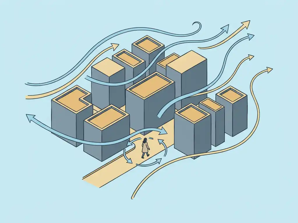
A pedestrian wind comfort assessment evaluates how wind conditions around a building or development affect the people who use the surrounding outdoor spaces. It tells you whether wind speeds at street level are acceptable for the intended activities — walking, standing, sitting — and flags any locations where conditions may be uncomfortable or unsafe. In the Netherlands, this type of study is often a formal requirement as part of a permit application. Below, we answer the most common questions about how these assessments work and when you need one.
When is a pedestrian wind comfort assessment legally required?
In the Netherlands, a pedestrian wind comfort assessment is legally required when a building project is likely to affect wind conditions at street level — typically for high-rise buildings, large-scale area developments, or projects in exposed locations. Municipalities can require a wind study as part of the permit application process, and many do so as standard for buildings above a certain height.
The trigger is usually a combination of building height and urban context. A building that is more than twice as tall as its surroundings significantly increases the risk of wind problems at ground level, and most municipalities will ask for a study before granting a permit. Even when it is not formally required, developers and architects often commission an assessment to validate their design before committing to it — discovering a wind problem after construction is far more expensive than addressing it during the design phase.
In practice, the requirement varies by municipality. Some have explicit policies that specify when a wind study is mandatory; others apply a case-by-case judgment based on the project type and location. If you are unsure whether your project requires a formal assessment, the safest approach is to check with the relevant municipality early in the process — or ask a specialist who knows the local regulatory landscape.
What is the difference between NEN 8100 and the Lawson criteria?
NEN 8100 and the Lawson criteria are both methods for classifying pedestrian wind comfort, but they use different thresholds and are applied in different countries. NEN 8100 is the Dutch standard, used for permit applications in the Netherlands. The Lawson criteria are widely used in the UK, Canada, and internationally. The core difference is how each method defines acceptable wind conditions for specific activities.
NEN 8100 classifies locations based on the probability that wind speeds exceed 5 m/s. The resulting comfort class determines whether a location is suitable for its intended use — for example, a terrace requires a stricter classification than a through-route. Wind hazard is assessed separately, using a threshold of 15 m/s: an exceedance probability above 0.30% is considered dangerous and unacceptable.
The Lawson criteria assign a threshold wind speed to each type of activity and require that speed to be exceeded no more than 5% of the time. The thresholds are higher than those in NEN 8100 for most activities, which means Lawson can produce more optimistic results for the same location. Research from the Rotterdam pilot study we contributed to showed that Lawson classified only the Erasmus Bridge as uncomfortable, while several other locations were clearly problematic in practice.
Here is a quick comparison:
- NEN 8100 sitting threshold: 5 m/s, exceedance probability determines comfort class
- Lawson sitting threshold: 4 m/s exceeded no more than 5% of the time
- Lawson walking threshold: 10 m/s exceeded no more than 5% of the time
- NEN 8100 danger threshold: 15 m/s exceeded more than 0.30% of the time
- Lawson danger threshold: 15 m/s exceeded more than 0.025% of the time (for vulnerable groups)
For projects in the Netherlands, NEN 8100 applies. For projects in the UK or internationally, Lawson is the relevant standard. Some projects — particularly those with international clients or cross-border ambitions — require familiarity with both.
How does a pedestrian wind comfort assessment actually work?
A pedestrian wind comfort assessment uses either a physical wind tunnel test or a CFD (Computational Fluid Dynamics) simulation — or a combination of both — to model wind behavior around a building or development. The result is a detailed picture of wind speeds at pedestrian height across the site, classified against the relevant comfort standard.
The process typically follows three stages:
- Building the 3D model: A digital model of the site is constructed using geodata, including existing buildings, proposed new volumes, and the surrounding urban context. Buildings smaller than one metre in detail are usually omitted, as they have minimal influence on the results. A buffer zone of at least 250 metres around the core area is included to ensure wind flows into the model correctly.
- Running the simulation: Wind is simulated from multiple directions, weighted according to local wind statistics. For Dutch projects, this is based on long-term meteorological data. The simulation calculates wind speeds at pedestrian height across the entire site.
- Classifying the results: The calculated wind speeds are mapped against the relevant standard — NEN 8100 for the Netherlands, Lawson for international projects. The output shows which areas meet the required comfort class for their intended use and which do not.
Wind tunnel testing remains useful for individual buildings and smaller masterplans where a physical model is practical. For large-scale urban areas — city districts, area developments, or masterplans covering multiple blocks — CFD simulation is the more appropriate method, as it scales without the physical limitations of a tunnel.
What does a wind comfort report include and how is it used?
A wind comfort report presents the results of the assessment in a format that can be used directly in permit applications, design reviews, and stakeholder presentations. It includes colour-coded maps showing wind comfort classifications across the site, a summary of locations that meet or fail the relevant standard, and recommendations where conditions require improvement.
The colour-coded maps are particularly useful because they make complex airflow data immediately readable — for architects, planners, and permit authorities alike. A well-structured report does not just tell you where the problem is; it gives you enough context to understand why it occurs and what can be done about it.
In practice, the report serves several purposes. It supports the permit application by demonstrating that wind conditions have been assessed against the applicable standard. It gives the design team actionable input during the design process. And it provides a defensible record if questions arise later — from the municipality, a client, or a third party reviewing the project.
For projects covered by wind engineering requirements in the UK, the report may also need to include an Environmental Statement wind chapter, which forms part of the planning application. The format and level of detail required varies by jurisdiction, so it is worth confirming the specific requirements with the relevant authority before the study begins.
What happens if a wind comfort assessment reveals wind hazards?
If a wind comfort assessment shows that conditions at certain locations are uncomfortable or dangerous, the design needs to be adjusted before the project can proceed. This is not unusual — many assessments identify at least some locations that require attention, particularly around building corners, entrances, and open squares. The important thing is to catch these issues early, when design changes are still straightforward.
Mitigation measures range from large-scale urban design decisions to targeted interventions at building or street level. The most effective solutions address wind problems at the source — the building’s shape, orientation, and relationship to its surroundings. Measures applied later, at street level, are generally less effective and more expensive.
Common mitigation strategies, roughly in order of effectiveness:
- Urban layout: Cluster tall buildings so they shelter each other; limit height differences between adjacent buildings to around 30%; orient streets diagonally or perpendicular to the prevailing wind direction to avoid channelling effects
- Building volume and orientation: Avoid placing the widest facade perpendicular to the dominant wind direction; use setbacks of at least 5 metres depth for buildings around 100 metres tall
- Aerodynamic design: Rounded or tapered facades guide wind along the building rather than pushing it downward toward street level
- Covered walkways and galleries: Provide direct shelter for pedestrians; effective at a minimum depth of 5 metres for buildings of around 100 metres
- Screens and barriers: Redirect wind locally, but can create acceleration at the edges and may affect the visual or social character of a space
- Planting: Trees and hedges improve comfort, but are not a primary safety measure — deciduous trees lose their leaves in winter, when wind speeds are typically highest
One important principle: wind problems are much harder to solve at building level if wind has not been considered at the urban planning stage. Early integration of wind assessment into the design process gives you the most options and the least disruption.
How Actiflow helps with pedestrian wind comfort assessments
We have been carrying out pedestrian wind comfort assessments for over 21 years, working with municipalities, real estate developers, architects, and structural engineers across the Netherlands, Belgium, the UK, Gibraltar, and beyond. Our team knows the regulatory requirements of Dutch municipalities inside out, and we apply the Lawson criteria for international projects — so you get the right study for the right context, every time.
Here is what working with us looks like in practice:
- We advise you from the start on which type of assessment applies to your project and what the municipality will expect
- We build accurate 3D models using geodata and run CFD simulations on our own high-performance computing infrastructure
- We deliver colour-coded comfort maps and clear graphics that you can share directly with clients, planners, or permit authorities
- We flag wind hazards early and provide concrete design recommendations — not just a list of problems
- We handle projects at every scale, from a single high-rise to city-wide area studies like the comprehensive wind assessment we carried out for the city of Rotterdam
- For regular clients, we can start the next day if needed — speed and flexibility are part of how we work
You can find a full overview of our wind engineering services and other fluid dynamics expertise on the Actiflow website. Want to know more about us and how we work? Visit our about us page.
Curious how we can help with your pedestrian wind comfort assessment? Feel free to contact us. We would be happy to discuss your project and help you find the right engineering solution.
