
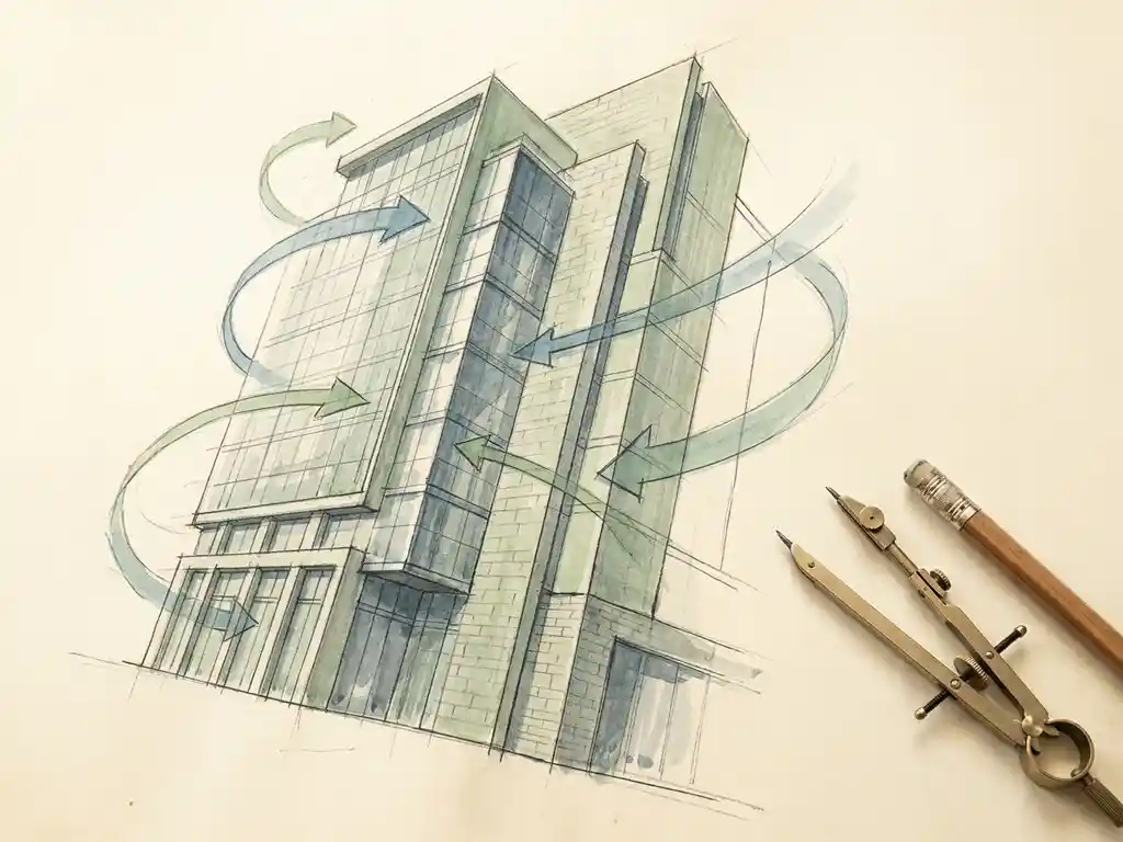
Architects use wind speed data in early design to make informed decisions about building orientation, massing, and layout before those choices become expensive to change. At concept stage, even basic wind data helps you avoid creating uncomfortable or unsafe conditions at ground level. The sections below cover the specific questions that come up most often when wind is introduced early in a project.
What wind data inputs do architects actually need at concept stage?
At concept stage, you need three things: the prevailing wind direction for your site, the typical wind speed at relevant heights, and a basic understanding of how surrounding buildings or terrain will affect airflow. You do not need a full wind comfort report yet. A wind rose showing dominant directions and a local meteorological dataset are enough to start making meaningful design decisions.
In the Netherlands, wind data typically comes from KNMI measurements, often processed according to the NPR 6097 standard that underpins NEN 8100 assessments. For international projects, other national datasets apply. What matters at concept stage is not pinpoint accuracy but directional awareness: where does the wind usually come from, how strong is it, and what happens when it hits a building of your proposed height and footprint?
A few rules of thumb are worth knowing from the start. A building more than twice the height of its immediate surroundings is likely to create wind problems at street level. Open facades facing the dominant wind direction on a square or plaza significantly increase the risk of discomfort. Knowing these thresholds early means you can flag potential issues before the design is locked in.
How does wind speed data influence building orientation and massing?
Wind speed data directly shapes decisions about which face of a building points into the wind, how tall and wide the structure is, and where setbacks or recesses are placed. These are not minor details. Getting orientation wrong can accelerate wind down to street level, creating discomfort or even hazardous conditions that are very difficult to fix later without major redesign.
The relationship between building width and wind direction is particularly important. Placing the broadest facade perpendicular to the dominant wind direction maximises the downwash effect, pushing fast-moving air toward pedestrians. Orienting the narrow edge into the wind reduces this dramatically. Similarly, street orientation matters: streets running parallel to the prevailing wind act as channels that accelerate flow, while streets running perpendicular or diagonal break it up.
Massing decisions work the same way. Clustering towers so they shelter each other, keeping height differences between adjacent buildings within roughly 30%, and using stepped setbacks at lower floors all reduce ground-level wind speeds. The setback rule of thumb is practical: for a building around 100 metres tall, a setback needs to be at least 5 metres deep to have a meaningful effect. Shallower than that and the downward flow simply reaches the pavement anyway.
What is the difference between a wind comfort study and a wind loading study?
A wind comfort study assesses the conditions experienced by people at ground level, typically pedestrians, cyclists, or people sitting on terraces. A wind loading study calculates the forces the wind exerts on the building structure itself, including facades, cladding, and load-bearing elements. Both use wind speed data, but they answer completely different questions and are used by different people in the project team.
Wind comfort assessments classify locations using standards such as NEN 8100 in the Netherlands or the Lawson criteria for international projects. NEN 8100 measures the probability that wind speed exceeds 5 m/s at eye height, then assigns a class from A (comfortable for sitting) to E (unacceptable for any use). The output is a colour-coded map showing which areas around a building are suitable for which activities. This is what architects and urban planners use to adjust layout and landscaping.
Wind loading studies produce force coefficients and pressure distributions that structural engineers use to size connections, specify cladding systems, and verify that the building can withstand storm conditions. These studies typically follow different standards and require different inputs. On most projects, both studies are needed, but they happen at different stages and serve different disciplines. Confusing the two leads to either over-engineering or, worse, missing a comfort problem that a loading study would never flag.
When in the design process should wind data be introduced?
Wind data should enter the design process at concept stage, before massing and orientation are fixed. The later wind is introduced, the more expensive any required changes become. A small adjustment to building orientation at concept stage costs nothing. The same adjustment after planning permission has been granted can mean months of delay and significant redesign cost.
In practice, many projects only commission a wind study when a permit authority requests one, which is typically late in the process. By that point, the design is largely set and the study becomes a compliance exercise rather than a design tool. If the results show problems, the options are limited: add screens, plant trees, or accept a lower comfort classification. None of these are as effective as addressing the issue in the massing stage.
The most useful moment to bring in wind expertise is when the urban context is being set and the first volumetric options are on the table. At that point, a relatively quick assessment of the proposed massing against local wind data can identify which options are likely to perform well and which are likely to fail, without the cost of a full study. This is where wind engineering consultancy adds the most value per euro spent.
How does CFD simulation turn wind speed data into design guidance?
CFD (Computational Fluid Dynamics) simulation takes wind speed and direction data as inputs, applies them to a detailed 3D model of the building and its surroundings, and produces a spatial map of airflow conditions across the entire site. This turns abstract meteorological data into specific, location-by-location guidance that architects and planners can act on directly.
The process starts with building a 3D model from geodata, incorporating existing and approved buildings in the surrounding area. The air volume above and between buildings is then divided into millions of computational cells, and the simulation calculates how wind moves through the geometry for each relevant wind direction. The results are post-processed into maps showing wind speed, turbulence, and comfort classification at eye height.
What makes CFD particularly useful at design stage is that it allows you to test multiple design variants quickly. Change the orientation of a tower, add a setback, or adjust the height of an adjacent building, and you can see the effect on ground-level conditions without building a physical model. For large-scale area studies, CFD is the only practical method: physical wind tunnel testing cannot accommodate city-scale geometry.
The output is not just numbers. We produce colour-coded maps and visualisations that make complex airflow patterns immediately readable to architects, developers, and permit authorities alike. This is a meaningful difference from receiving a table of wind speeds: a map shows you exactly where the problem is and how far it extends, which is what you need to make a design decision. You can explore how this works in more detail on our CFD simulations page.
What design changes can fix wind problems found during early assessment?
When an early wind assessment identifies a problem, the fixes fall into a clear hierarchy. Changes at the urban planning level are most effective, followed by building volume and orientation adjustments, then architectural detailing, and finally landscaping or furniture. Working through this hierarchy in order gives you the best result for the least cost and disruption.
At the building volume level, the most effective interventions are:
- Setbacks at lower floors to interrupt downward flow before it reaches street level. These need to be at least 5 metres deep for a 100-metre building to be effective.
- Tapering or rounding the building form so wind flows around the structure rather than being deflected downward.
- Adjusting the height ratio between adjacent buildings to avoid large differences that create strong downwash at the transition point.
- Closing or narrowing passages that run in the direction of the dominant wind, since open gaps act as pressure shortcuts that accelerate flow.
If the building form cannot change, architectural elements can help. Canopies redirect downward flow but move it to the canopy edge rather than eliminating it, so they work best in combination with other measures. Covered walkways at least 5 metres deep provide direct protection for pedestrians. Wind screens redirect local flow but tend to accelerate wind at their edges and can affect how safe a space feels.
Landscaping and planting are useful for comfort improvement but should not be the primary fix for a serious wind problem. Trees lose their leaves in winter, exactly when wind speeds are highest, and trees in corner flows around buildings often grow poorly. Adjusting the function of a space, moving a terrace or entrance away from the most exposed location, is sometimes the simplest and most durable solution. A small shift in placement can move a space from an unacceptable wind class to an acceptable one without any structural change at all.
How Actiflow helps you use wind speed data effectively in design
We work with architects, developers, and project managers at every stage of the design process, from first massing options to permit submission. With over 21 years of experience in fluid dynamics consultancy, we know what information is actually useful at concept stage and what can wait. Here is what we bring to a project:
- Early-stage wind assessments that identify orientation and massing risks before the design is locked in, using CFD simulations calibrated to local meteorological data.
- Full NEN 8100 and Lawson assessments for permit applications, with colour-coded maps and clear reporting that you can submit directly to municipalities or share with clients.
- Large-scale area studies for masterplans and urban developments, including city-wide studies comparable to the comprehensive wind study we carried out for the city of Rotterdam.
- Fast turnaround: for regular clients, we set everything aside to start the next day if needed. Internal process automation continues to reduce delivery times further.
- International experience: we apply Lawson criteria for projects in the UK, Gibraltar, and beyond, in addition to our established work across the Netherlands and Belgium.
Curious how we can help with wind speed data in your early design process? Contact us. We would be happy to discuss your project and help you find the right engineering solution. You can also find out more on our about us page.
