
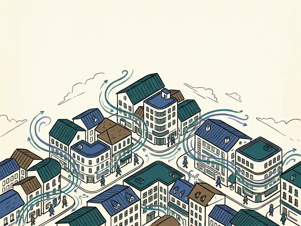
Urban layout shapes pedestrian wind comfort in six main ways: building height, spacing, orientation, open plazas, podium levels, and the presence of wind-mitigating design features. Each of these factors either amplifies or reduces wind speeds at street level, often dramatically. Understanding how they interact helps architects, developers, and urban planners make smarter design decisions before problems become expensive to fix.
How does building height influence wind speeds at street level?
Taller buildings accelerate wind at pedestrian level because they intercept fast-moving air from higher altitudes and deflect it downward. The taller a building relative to its surroundings, the stronger this downwash effect becomes. As a rule of thumb, a building that rises to more than twice the height of its immediate surroundings significantly increases the risk of wind problems at ground level.
This downward deflection is not evenly distributed. The strongest accelerations typically occur at building corners, in front of main entrances, and along facades facing the prevailing wind direction. At the base of a tall tower, wind speeds can be two to three times higher than in the open surroundings, which is why high-rise developments in exposed locations so often generate wind comfort complaints after completion.
Height differences between adjacent buildings also matter. When two neighbouring towers differ in height by more than roughly 30%, the taller building tends to channel and accelerate wind down onto the lower one and the space between them. Keeping height transitions gradual across a development reduces this risk considerably.
What role does building spacing play in channelling wind?
Building spacing determines whether wind flows smoothly around a development or accelerates through narrow gaps in a channelling effect. When buildings are spaced close together, wind is compressed as it passes between them, increasing speed significantly. The street-to-building height ratio, known as H/W, is one of the most useful tools for predicting this behaviour.
- H/W below 0.35: Buildings provide minimal shelter; most wind reaches street level
- H/W between 0.35 and 0.65: Partial wind reduction; needs to be weighed against ventilation requirements
- H/W above 0.65: Most wind is guided over the rooftops, improving comfort below
Clustering towers deliberately can actually work in your favour. When tall buildings are positioned so they shield one another from the prevailing wind, the group as a whole creates less ground-level turbulence than isolated towers would. This is sometimes called the Manhattan effect, and it is a genuinely useful principle in wind engineering for dense urban areas.
How does building orientation affect pedestrian wind comfort?
Building orientation affects pedestrian wind comfort by controlling whether facades and street corridors align with or cut across the prevailing wind direction. Orienting the widest facade perpendicular to the dominant wind increases the surface area catching wind and pushes more of it downward and sideways. Aligning the narrower edge into the wind reduces this effect significantly.
Street orientation follows the same logic. Streets running parallel to the dominant wind direction act as channels, accelerating flow along their length. Streets oriented perpendicular or at a diagonal to the prevailing wind direction interrupt this channelling and produce calmer conditions for pedestrians. In the Netherlands, where the dominant wind comes from the southwest, this is a practical consideration for any new street layout.
Passages and openings through buildings deserve particular attention. A gap or arcade aligned with the dominant wind direction creates a pressure shortcut, drawing air through at high speed. Where such openings are unavoidable, keeping them as narrow as possible limits the acceleration effect.
Why do open plazas and podium levels create wind hazard zones?
Open plazas and podium levels create wind hazard zones because they combine exposed surface area with the downwash from adjacent tall buildings, producing high-speed, turbulent conditions at ground level. When more than 25% of the windward side of a plaza is open facade, the risk of significant wind discomfort increases sharply. Podium rooftops sit directly in the downward airstream from the tower above, making them particularly unsuitable as outdoor amenity spaces without mitigation.
The Lloydpier area in Rotterdam is a clear example of this dynamic. Despite having no buildings above 70 metres, the area experiences high wind nuisance because southwesterly winds travel unobstructed across low industrial buildings and the river before hitting the development. The downward streams reach pedestrian level with little to slow them down.
Bridges face a related problem. Elevated, exposed structures like the Erasmusbrug in Rotterdam are classified as wind hazard locations under NEN 8100 because there is no surrounding built fabric to absorb or redirect the flow. The same principle applies to any elevated plaza or terrace with open exposure on multiple sides.
What urban design features can reduce wind discomfort for pedestrians?
Several urban design features reduce wind discomfort for pedestrians, and they work best when applied in a logical sequence: address the problem at the urban planning level first, then at the building level, and only then in the immediate public realm. Trying to fix a wind problem with planters and screens when the real cause is building layout is far less effective and far more expensive.
At the urban planning level, the most effective measures are clustering tall buildings, controlling height transitions, and managing street orientation. At the building level, setbacks are highly effective when they are deep enough. For a building of around 100 metres, a setback of at least 5 metres is needed to meaningfully redirect downwash. The roof level of a setback is itself exposed to downward airflow, so it should not be used as an outdoor terrace without further measures.
Covered walkways protect pedestrians directly, but they need to be at least 5 metres deep to be effective, and the area immediately beside the gallery remains unprotected. Canopies are less effective than setbacks because they simply push the downward airflow to the canopy edge rather than redirecting it. Planting, including trees and hedges, improves comfort but should not be relied on as a primary safety measure. Deciduous trees lose their leaves in winter, exactly when wind speeds are highest.
One principle worth keeping in mind: wind problems are much harder to solve at the building scale if wind was not considered at the urban planning scale first. Early integration of wind comfort thinking into masterplan decisions saves significant time and cost later.
When should urban wind comfort be assessed during a development project?
Urban wind comfort should be assessed as early as possible in a development project, ideally during the masterplan or concept design phase. Assessing wind conditions at this stage allows design teams to adjust building heights, orientations, and spacing before those decisions are locked in. Waiting until the permit application stage limits the available solutions and increases the cost of any required changes.
In the Netherlands, a wind study is often required as part of the permit application process, particularly for high-rise buildings or area developments where wind impact on public spaces is a concern. The applicable standard is NEN 8100, which classifies wind conditions into five classes from A (comfortable) to E (poor) based on the probability of wind speeds exceeding 5 m/s at eye level. For projects outside the Netherlands, the Lawson criteria serve the same purpose and are widely accepted by planning authorities in the UK and internationally.
A practical approach is to run a preliminary wind assessment during concept design to identify risk areas, then follow up with a detailed study once the building geometry is more defined. This two-stage approach gives design teams the information they need at each decision point without commissioning a full study before the design is stable enough to assess meaningfully.
How Actiflow helps with pedestrian wind comfort
We assess pedestrian wind comfort for projects of all scales, from individual high-rise buildings to city-wide masterplans. Our work for the city of Rotterdam is one of the largest urban wind studies ever carried out in the Netherlands, covering a study area with a diameter of around 5 kilometres and a computational mesh of more than 583 million cells. We bring the same level of technical rigour to smaller projects, including single-building assessments for permit applications.
- CFD simulations and wind tunnel testing using the methods best suited to your project scale and regulatory context
- NEN 8100 assessments for Dutch permit applications, including colour-coded comfort maps that can be submitted directly to municipalities
- Lawson criteria assessments for projects in the UK, Gibraltar, the Middle East, and other international markets
- Early-stage design advice that helps you identify and resolve wind problems before they become costly to fix
- Clear, visual reporting with graphics and maps that are directly presentable to clients, planners, and permit authorities
- Fast turnaround with high process automation, and for regular clients, the ability to start the next day if needed
With over 21 years of experience in fluid dynamics and a strong track record with municipalities, developers, and engineering consultancies across the Netherlands, Belgium, and beyond, we know what a good wind study needs to look like to hold up under scrutiny. Contact us if you would like to discuss your project, or visit our about us page to learn more about who we are and how we work.
