
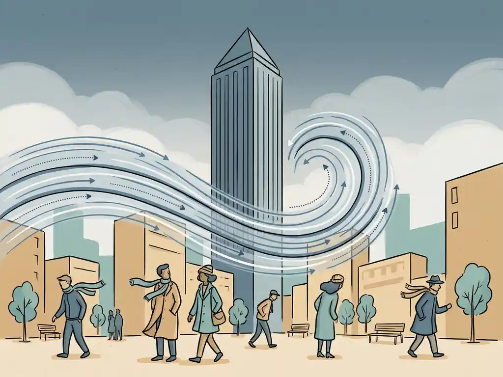
Tall buildings create wind problems at street level because they intercept fast-moving air high up and redirect it downward toward pedestrians. The taller a building is relative to its surroundings, the more wind energy it pushes down to ground level. Understanding exactly how and where this happens helps architects and developers make smarter design decisions from the start.
How do tall buildings change the wind around them?
Tall buildings disrupt the natural flow of wind by acting as large obstacles in the atmospheric boundary layer. Wind speed increases with height, so a tower that rises well above its surroundings intercepts faster, stronger air and forces it to go somewhere. That somewhere is usually down, around the sides, and through any gaps between buildings.
A useful rule of thumb: a building that is more than twice the height of its immediate surroundings is significantly more likely to cause wind problems at street level. The surrounding context matters just as much as the building itself. A 100-metre tower in a neighbourhood of 50-metre buildings behaves very differently from the same tower standing alone on an open site.
Street geometry also plays a major role. The ratio of building height to street width (H/W) strongly influences how much wind reaches the ground. When H/W is below 0.35, most wind travels across the rooftops and reaches the street relatively easily. When H/W exceeds 0.65, the building mass deflects most wind up and over, actually reducing ground-level exposure. The middle range, between 0.35 and 0.65, produces mixed results that depend heavily on orientation and building shape.
Street orientation matters too. Streets that run parallel to the prevailing wind direction act as channels, accelerating airflow through them. Streets oriented perpendicular or diagonal to the dominant wind direction are much less prone to this channelling effect. In the Netherlands and much of Western Europe, the prevailing wind comes from the southwest, which makes northeast-to-southwest street alignments particularly risky from a wind engineering perspective.
What is the downdraft effect and why is it so strong near tall towers?
The downdraft effect occurs when wind hits the windward face of a tall building and is deflected downward toward the ground. This happens because the building creates a high-pressure zone on its windward side, and air naturally moves from high pressure to low pressure, pushing a strong column of air down the facade and into the street below.
The effect is strongest near tall, freestanding towers for two reasons. First, there is no neighbouring building to block or absorb the incoming wind before it hits the facade. Second, the taller the building, the faster the wind it intercepts at height, and the more energy that downward flow carries to street level. Near a 70-metre tower, downward flows can remain strong enough to affect pedestrians at ground level, as documented in studies of areas like the Lloyd Tower in Rotterdam.
The area directly in front of the windward facade, at the base of the building, typically experiences the most intense downdraft conditions. Corner areas are also strongly affected, as wind wraps around the building edges and accelerates sharply.
Which building shapes and configurations make wind problems worse?
Flat, wide facades oriented perpendicular to the prevailing wind direction are the worst configuration for pedestrian wind comfort. They present the maximum surface area to incoming wind, maximising the pressure difference that drives downdrafts. A building with its broadest face directly into the wind will consistently produce stronger ground-level effects than one aligned with its narrower face toward the wind.
Several other factors make wind problems significantly worse:
- Large height differences between adjacent buildings: When a tall tower stands next to much shorter buildings, the height contrast amplifies downdraft and corner effects. A maximum height difference of around 30% between neighbouring buildings is a useful benchmark for reducing these problems.
- Passageways and gaps aligned with the wind: Any opening through or beneath a building that faces the dominant wind direction creates a pressure shortcut, accelerating air through the gap and onto the street. If such openings are unavoidable, making them as narrow as possible reduces the effect.
- Open plazas on the windward side: When more than 25% of the windward facade of a square or plaza is open, the risk of significant wind nuisance increases sharply. Open plazas offer no shelter and allow downdrafts to spread freely at ground level.
- Isolated towers without neighbouring buildings for mutual protection: A cluster of towers can shelter each other, the so-called Manhattan effect, but a single freestanding tower has no such protection and exposes the surrounding streets to the full force of redirected wind.
Where around a building are wind conditions most dangerous for pedestrians?
The most dangerous wind conditions for pedestrians are typically found at building corners, directly in front of windward facades at ground level, and in any passageways or gaps that channel wind through or beneath the building. These locations consistently produce the highest wind speeds and the greatest risk of discomfort or danger.
Corner zones are particularly hazardous because wind accelerates as it wraps around a building edge, combining the downdraft from the facade with the horizontal flow around the sides. This creates a zone of fast, turbulent, unpredictable airflow that can catch pedestrians off guard.
Building entrances placed at corners or on windward facades are especially problematic. The same location that receives the strongest downdraft is often also where people stop, wait, or change direction, which is exactly when wind exposure causes the most discomfort and risk.
Bridges and riverbanks near tall buildings are another category of high-risk location. The open water surface provides no shelter, and buildings on the bank redirect wind downward onto already-exposed crossing points. Rotterdam’s Erasmusbrug and sections of the Willemsbrug are documented examples where wind hazard levels, classified as dangerous under NEN 8100, occur regularly during storms.
How is pedestrian wind discomfort assessed and measured?
Pedestrian wind comfort is assessed by comparing the wind speeds that occur at specific locations around a building against accepted comfort and safety thresholds, taking into account how often those speeds occur throughout the year. The two main frameworks used in practice are the NEN 8100 standard, which applies to projects in the Netherlands, and the Lawson criteria, which are widely used for international projects.
Both frameworks classify locations on a scale from comfortable to dangerous based on the combination of wind speed and exceedance frequency. Under NEN 8100, the classification runs from class A (comfortable for all activities) through to class E (dangerous). A location classified as dangerous is one where wind speeds above 15 m/s occur more than 0.30% of the time, which is considered unacceptable regardless of the activity taking place there.
Two methods are used to gather the wind speed data that feeds into these assessments:
- Wind tunnel testing: A physical scale model of the building and its surroundings is placed in a wind tunnel, and sensors measure wind speeds at pedestrian height. This method works well for individual buildings and smaller masterplans.
- CFD simulation: A computational model of the building and its urban context is built and solved using fluid dynamics software. This is the preferred method for large-scale or city-wide assessments, where building a physical model would be impractical. Our CFD simulations produce colour-coded maps that make wind conditions immediately readable for architects, planners, and permit authorities.
Both methods use local meteorological data to reflect actual wind conditions at the site. In the Netherlands, this typically means using KNMI wind data processed according to NPR 6097, which is the standard required for permit procedures under NEN 8100.
What design changes can reduce wind problems at street level?
Wind problems at street level are best addressed in a clear order of priority, starting with the building’s volume and position, then its shape, and finally supplementary measures in the immediate surroundings. Trying to fix wind problems with trees and screens after the building is designed is much harder than addressing them at the urban planning or massing stage.
The most effective design interventions, roughly in order of impact, are:
- Setbacks (stepped building profiles): Stepping a building back at lower floors reduces the height of the windward face and limits how far downdrafts travel toward street level. A setback needs to be at least 5 metres deep for a building of around 100 metres to be effective. Note that the roof level of the setback itself sits in the downdraft zone and is not suitable as an outdoor terrace.
- Aerodynamic facade shapes: Rounded or tapered facades allow wind to flow around the building rather than being deflected straight down. This significantly reduces the intensity of corner and downdraft effects compared to flat, square facades.
- Clustering of towers: Grouping tall buildings together so they shelter each other is one of the most effective urban planning tools. Rotterdam’s Wijnhaveneiland achieved almost entirely class A conditions through a combination of tower clustering and strategic setbacks.
- Covered walkways: Arcades or canopies at least 5 metres deep provide direct protection for pedestrians. They do not reduce wind speeds but physically shield people from the worst of the downdraft. The area beside the covered walkway remains unprotected.
- Canopies at building entrances: Less effective than setbacks, canopies shift the downdraft to the canopy edge rather than eliminating it, but they do provide practical shelter at the point where pedestrians are most exposed.
- Planting and screens: Vegetation and wind screens can improve comfort in specific spots but are not reliable as primary measures. Deciduous trees lose their leaves in winter, precisely when wind speeds are highest. Screens accelerate wind at their edges and can create new problem zones.
- Adapting the use of spaces: Sometimes the simplest fix is relocating a terrace, entrance, or playground by a few metres to move it out of the worst wind zone. When structural changes are not possible, rethinking how a space is used can make a real difference.
The most important principle is that wind problems are far easier to prevent than to cure. Once a building is built, the options narrow quickly and the remaining solutions are less effective and more expensive. Bringing wind assessment into the early design phase, rather than treating it as a permit formality, gives architects and developers the most room to act. You can explore the full range of approaches on the Actiflow website.
How Actiflow helps with pedestrian wind comfort
We have been assessing pedestrian wind comfort around buildings and urban developments since 2005, working with architects, developers, municipalities, and structural engineers across the Netherlands, Belgium, the UK, and beyond. Our background as a Delft University of Technology spin-off means we combine academic rigour with practical experience on real projects, from individual high-rise assessments to city-wide studies like the wind mapping project we carried out for the city of Rotterdam.
Here is what working with us looks like in practice:
- We assess your project using CFD simulations or wind tunnel testing, depending on the scale and stage of your design
- We apply the right standard for your project: NEN 8100 for projects in the Netherlands, Lawson criteria for international work
- We produce colour-coded maps and clear visual output that you can submit directly to a municipality or share with a client without needing to translate the technical findings
- We advise on design changes when results show wind problems, working with your team to find solutions that fit the project rather than just flagging the issue
- We are known for fast turnaround and direct communication: for regular clients, we can start the next day if the deadline demands it
- We stay with the project from intake to final report, giving you a single point of contact throughout
Curious how we can help with pedestrian wind comfort? Contact us and we will be happy to discuss your project and help you find the right approach. You can also find out more about us and our background in wind engineering.
Related Articles
- Why is wind comfort important in high-rise developments?
- What wind speeds are acceptable for outdoor pedestrian comfort?
- What are 3 common wind speed problems in dense city developments?
- Which 3 building orientations create the worst wind speed issues?
- How does urban geometry influence wind flow patterns?
